
History
Early History
The Monument contains evidence from campsites to villages occupied by ancient hunter-gatherers, the Hohokam, and the Tohono O’odham. There also are remnants of a small mission constructed in the late 1700s by Tohono O’odham laborers for Spanish Franciscan friars, and remnants of mining camps and cemeteries dating to the 1800s. There are three historic properties that have been placed on the National Register of Historic Places. They are the Los Robles Archaeological District, Cocoraque Butte Archaeological District, and the Santa Ana de Cuiquiburitac Mission site. Surveys within the IFNM have recorded 343 archaeological and historical sites, but the survey data suggests that there may be as many as 3,000 sites. Evidence of the Hohokam people dominates the archaeological record, with sites that include trash mounds, roasting pits, petroglyphs and numerous types of artifacts. The abundance of historical sites and artifacts is another reason for the preservation of IFNM, and it also provides further opportunities for education.
National Register of Historic Places
Three areas within the Ironwood Forest National Monument have been recognized as having special significance, prior to the designation of the area as a National Monument. These sites include the Los Robles Archaeological District, the Cocoraque Butte Archaeological District, and the Santa Ana de Cuiquiburitac Mission Site.
As with all archeological and historical resources, they are Monument objects and are protected by federal law. Do not touch, move, disturb or in any way alter the appearance or state of any of these irreplaceable treasures.
The mission located within Ironwood Forest National Monument, Santa Ana de Cuiquiburitac, was closely tied to the missions at San Xavier del Bac and Tumacacori. However, the location of Cuiquiburitac is barely discernible, save a few stones marking the outline of its foundation. For a more historical perspective of this mission, the Friends received permission to publish the following article.
Santa Ana de Cuiquiburitac: Pimeria Alta’s Northernmost Mission – Bernard L. Fontana
Originally published in the Journal of the Southwest, Vol. 29, No. 2, Summer 1987, Copyright by the Arizona Board of Regents. Edited by Joseph C. Wilder.
Article reprinted with permission from Journal of the Southwest, University of Arizona Press, The Southwest Center, Tucson.
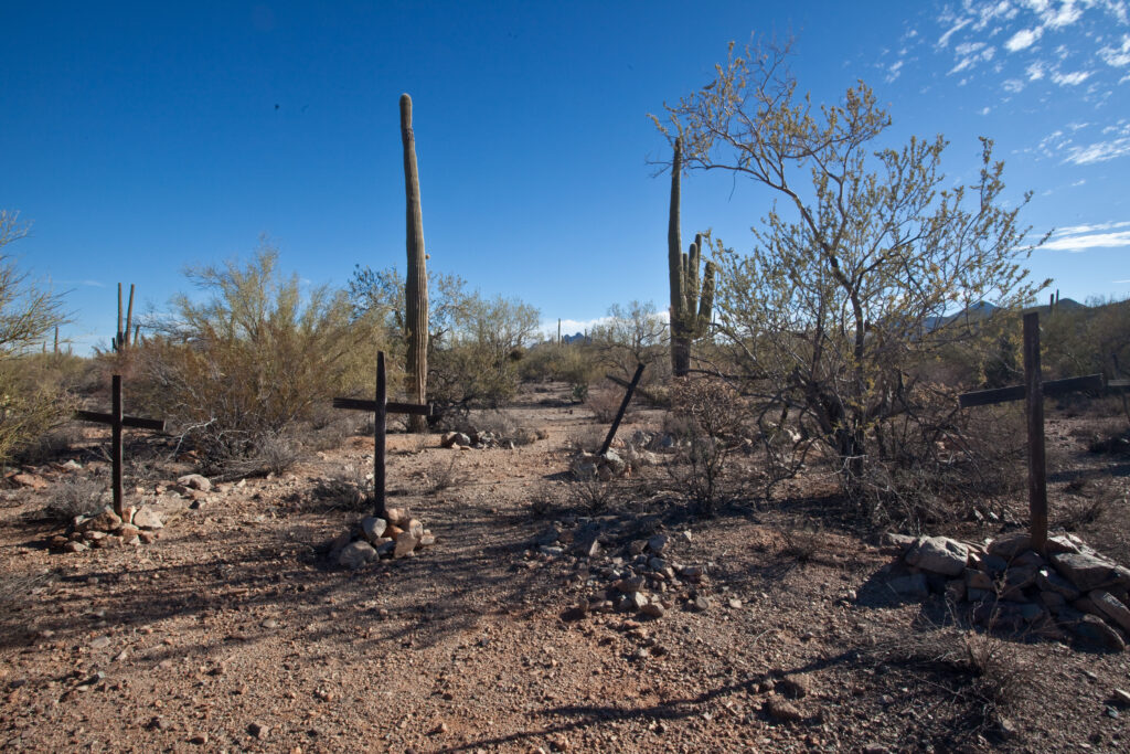
The town of Silver Bell
Well before the monument was created, the historic mining town of Silver Bell flourished between 1903 and the 1930s. As many as 1,000 people lived in the town, which boasted mercantile stores, saloons, laundries, bakeries, a post office, a hospital, and a school. But this town was just part of the history of the area.
Read more about the town of Silver Bell here and the cemetery here.
The Proclamation Establishing Ironwood Forest National Monument
William J Clinton
June 9, 2000
By the President of the United States of America
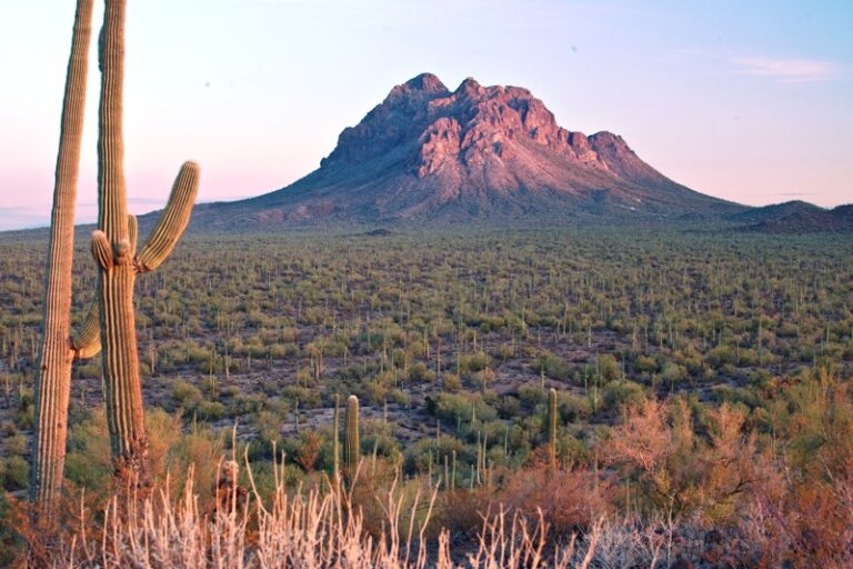
The landscape of the Ironwood Forest National Monument is swathed with the rich, drought-adapted vegetation of the Sonoran Desert. The monument contains objects of scientific interest throughout its desert environment. Stands of ironwood, palo verde, and saguaro blanket the monument floor beneath the rugged mountain ranges, including the Silver Bell Mountains. Ragged Top Mountain is a biological and geological crown jewel…
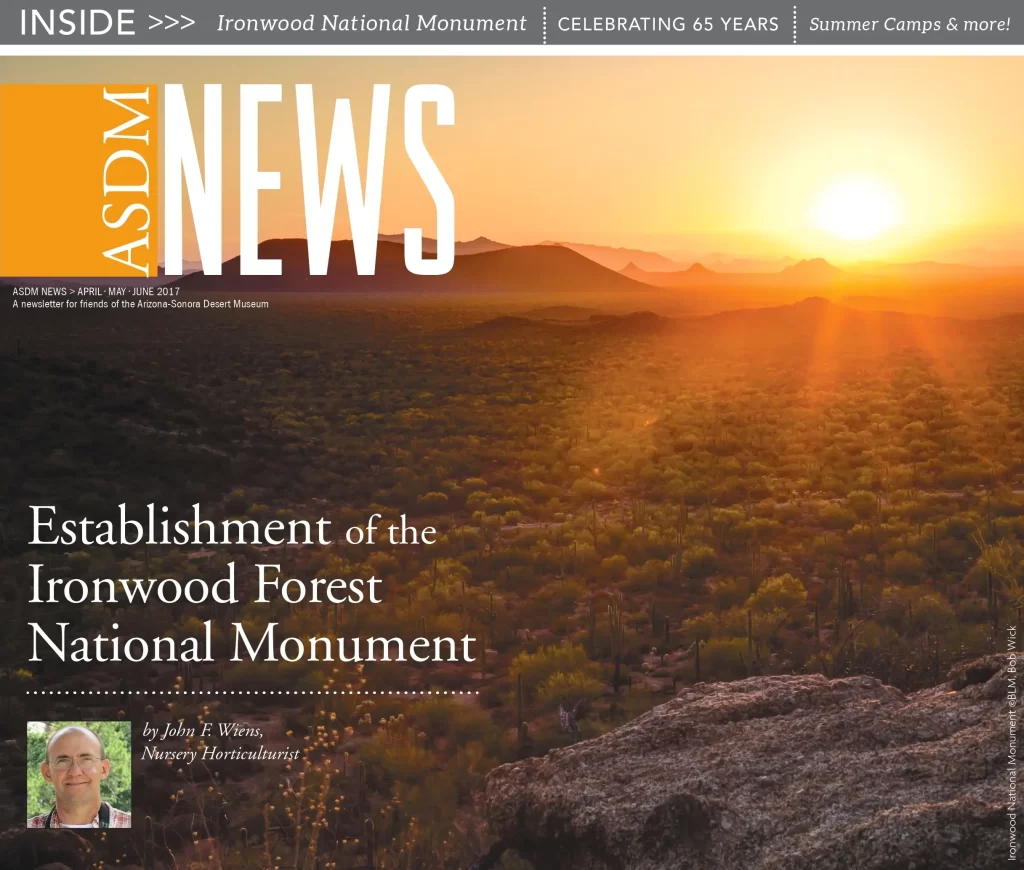
Establishment of the Ironwood Forest National Monument
by John F. Wiens, courtesy of the Arizona-Sonora Desert Museum
ASDM News, April May June 2017
In the 19th and early 20th centuries, the Southwest frontier was viewed as a great resource for mining, grazing, and agriculture. Gradually attention was given to preservation of the Sonoran Desert landscape. Read more…
Historical Documents Related to Monument Establishment
Proposal in Support of the Ironwood Preserve
Proposal for the Establishment of the Morris K Udall Ironwood Forest – Upland Corridor National Monument
Pre Plan Analysis for the Ironwood Forest National Monument, February 2001
Natural History, Archaeology, and Cultures of Southern Arizona’s Ironwood Forest
History of the International Biological Programme (IBP)
In early 2026, the Friends discovered the remains of a historic ground-breaking scientific research site located within Ironwood Forest National Monument. The Silverbell Validation site was part of the International Biological Programme (IBP) and was active during much of the 1970s. A summary of the site’s research, significance, and current management of its artifacts are featured in the Fall 2026 Ironwood Essence newsletter. Additional details and supplemental infomation not included in the newsletter are available below.
The IBP arose during the post-World War II era of expanding governmental support for science. Its inspiration was the International Geophysical Year (IGY) of 1957-58, collaborative program that involved 67 countries and over 60,000 scientists in the study of the planet’s physical systems. IGY produced many notable advances, including earth-observing satellites (Sputnik I, and Explorer 1, which discovered the Van Allen radiation belt), and the start of long-term measurements of atmospheric carbon dioxide (CO2) on Hawaii’s Mauna Loa volcano. The first-of-their-kind measurements of this potent “greenhouse gas” demonstrated two trends in atmospheric CO2 levels. First, CO2 was accumulating in the atmosphere – a predicted outcome of human activities like fossil-fuel burning. Second, the accumulation was set against background fluctuations of CO2 caused by natural processes such as plant growth, volcanic activity, and organic decomposition.
Impressed by the IGY’s success in its “Big Science” approach to “Big Problems”, a group of environmental scientists in Europe proposed a follow-up program – the International Biological Programme (IBP – to tackle the Big Problem of understanding energy/carbon flow through Earth’s ecological systems (“ecosystems” for short). By doing so, IBP hoped to understand factors that determine the ability of ecosystems to produce “goods” (like food) and “services” (like pest control or water purification or climate control) that are critical to human well-being. It was an aspirational program, spanning a decade (1964-1974), and involving over 50 countries and 1800 scientists in the U.S. alone.
The United States joined IBP in 1968 after Roger Revelle, a central figure in IGY and climate science, convinced Congress to appropriate funds to establish a new Ecosystems Studies program at the National Science Foundation. The US/IBP program focused on developing models of energy flow in five major North American ecosystems (biomes) – deciduous forest, coniferous forest, grassland, tundra, and desert – that would be ground- truthed (i.e., variables in the theoretical models would be measured in the field) at “validation” sites and compared with equivalent sites in other participating countries. For its time this was an incredibly complex and ambitious undertaking.
How the Silverbell site was chosen
The Desert Biome Research Design was published in July 1970, resulting from the work of ca. 300 scientists over 29 months. The IBP Tucson Validation Site was first proposed for a location in (then) Saguaro National Monument in the Tucson Mountains but was soon abandoned when it was learned that the area was closed to disturbance.
A second site was actually established in the spring of 1970 along Avra Valley Road on an alluvial fan of the Silverbell Mountains. It was on BLM land and researchers had negotiated termination of a grazing lease on the site, only to learn that the American Smelting and Refining Company (ASARCO) had staked mining claims in the area in July of that same year. Research was underway, but when the IBP team learned that mining exploration was planned, most validation studies were halted. By mid-October it was apparent that ASARCO’s activities would render the site unsuitable for IBP purposes. As a result, ASARCO offered to bear most of the costs associated with moving to a different site.
The new (third) site was situated 10 km to the northwest and found to be similar enough to the Silverbell Mountain site that the research design didn’t need to be modified. The grazing lease on the new location was canceled by the BLM and mining leases were excluded. Thus, IBP Sonoran Desert studies got underway by early 1971 at the “new” Silverbell site and the Tucson Validation Site was called the Silverbell site in reports from then on. This is the site we discovered.
Who worked at the site
By virtue of its considerable arid lands expertise, the University of Arizona (UA) administered the Sonoran Desert Biome studies. John Thames in Renewable Natural Resources was the coordinator, and other UA scientists and their graduate students comprised most of the Tucson Basin validation site teams.
How the site and its remaining artifacts were assessed for determination of historic significance
Upon its discovery in 2026, the IBP Silverbell site was evaluated for inclusion on the National Register of Historic Places (NRHP) in accordance with the criteria stipulated in Section 106 of the National Historic Preservation Act. Determination of NRHP eligibility has become the default in heritage resource management for deciding whether a historic object or property has enough historic significance to warrant elevated protection–e.g., avoidance or mitigation should any development or other ground- disturbing activities take place there.
To be eligible for the NRHP, cultural resources must have national, state, or local significance in American history, architecture, archaeology, engineering, or culture and be at least 50 years old, unless they are exceptionally significant. Cultural resources also must have sufficient integrity of location, design, setting, materials, workmanship, feeling, and association to convey their historic values and meet at least one of four criteria:
- § Be associated with events that have made a significant contribution to the broad patterns of our history (Criterion A)
- § Be associated with the lives of persons significant in our past (Criterion B)
- § Embody the distinct characteristics of a type, period, or method of construction, or that represent the work of a master, or that possess high artistic values, or that represents a significant and distinguishable entity whose components may lack individual distinction (Criterion C)
- § Have yielded, or may be likely to yield, information important in prehistory or history (Criterion D)
Additionally, considerations of integrity were also applied during the evaluation of the site’s eligibility for inclusion in the NRHP. Integrity is defined by 36 CFR 60 as “the ability of a [site] to convey its significance,” and comprises seven primary aspects:
- § Location is the place where the historic property was constructed or the place where the historic event occurred.
- § Setting is the physical environment of a historic property.
- § Design is the combination of elements that create the form, plan, space, structure, and style of a property.
- § Materials are the physical elements that were combined or deposited during a particular period of time and in a particular pattern or configuration to form a historic property.
- § Workmanship is the physical evidence of the crafts of a particular culture or people during any given period in history or prehistory.
- § Feeling is a property’s expression of the aesthetic or historic sense of a particular period of time.
- § Association is the direct link between an important historic event or person and a historic property.
The IBP site was assessed for historic significance according to these standards and in consultation with the Arizona State Historic Preservation Office (SHPO). The BLM and the SHPO determined that the story of the IBP and the role it played in the history of the region, the country, and science as a whole is of immense historical importance – but that the site itself comprises discarded materials used by scientists in the unfolding of that story, and are not in themselves significant.
The significant “objects”: Artifacts vs knowledge building
The distinction boils down to one of representation. Historically significant sites and objects are those that convey their historicity and importance as-is. The cliff dwellings of Mesa Verde, for example, tell a story of architectural planning, massively organized group labor, cultural stylistic choices with regard to orientation and decoration, and much else besides. In the case of something like an artifact scatter, a classic example would be a Clovis or Folsom site like those in northern New Mexico, where the presence of historically distinctive and diagnostic Clovis or Folsom artifacts tell a story about how people were using the landscape eight- to twelve-thousand years ago.
In the case of the IBP, the story is a fascinating and extremely important one in the history of the country and the international scientific community, but the tools they used – and then discarded and left behind – aren’t historically distinctive or diagnostic in their own right. Small animal and “frass” insect traps were created for the project, and the flume and weather station foundation were created in situ by IBP researchers, but their design and materials were all pretty commonplace even today.