Places of Interest
Silver Bell Cemetery
This post was from our Fall 2020 newsletter article on the Silver Bell Historical Society.
The earliest community in this area was Pelton, which boasted a population of 276 people in 1882 and lasted until about 1901. The town supported the Young America and Old Boot mines. Today, remains of the smelter site can be seen as well as a dozen or more graves at its cemetery site.
The Old Boot mine had its beginning about 1865 and was purchased and revitalized by wealthy investors from Tucson. In 1902, most of the mines in the area were acquired by the Imperial Copper Company, which created the first community of Silver Bell. As many as 1,000 people lived there. The town boasted mercantile stores, saloons, laundries, bakeries, a post office, a hospital, and a school. Silver Bell lasted until the early 1930s when the mines shut down.


A railroad was built between Red Rock on the Southern Pacific Railroad and Silver Bell. A large smelter and electric power house served the mines at the community of Sasco in Pinal County. The railroad passed through Sasco (a town of 600 people) on its way to Silver Bell. The ruins of Sasco still stand today. The old railroad bed can be found in many areas and railroad spikes can be found along its bed today.
There were 131 recorded burials at the Silver Bell Cemetery, which is protected by the Bureau of Land Management (and the Ironwood Forest National Monument). Residents of Silver Bell as well as ranchers from the area were buried there.
The Silver Bell Historical Society was formed in the summer of 2018 with a vision of preserving the history of the communities that existed within the Silver Bell Mountains of Pima County, Arizona. Every member of the board of directors lived in the town of Silver Bell, which existed from 1951 until 1984. They are dedicated to maintaining a community spirit among those who lived in Silver Bell, as well as their descendants.
The Society’s website is www.silverbellaz.com
Their mailing address is PO Box 13572, Tucson, AZ 85732.

Titan Missile Site
Many Arizonans probably don’t know that this site was home to one of the world’s most destructive weapons to ever exist.
The Titan II missile was capable of 25 times the speed of sound and had a target range of 5500 miles. Now, this site is an easy way for people to see Sonoran desert plants and get an informational tour of a fascinating piece of our military history.
To access the site, you travel mostly on paved roads and turn onto a graded dirt section for about ½ mile. There are multiple parking spaces including an accessible space with a paved pad. There is a graded gravel trail used to tour the missile site which used to house an underground silo and living quarters. Interpretive signs on site describe the history of the Titan missile program including the development, manning, and eventual destruction of the missile site.
In partnership with the US Air Force, the BLM and Arizona Native Plant Society, volunteers have been helping the native Sonoran Desert plants reclaim the once highly disturbed area. This work reanimates the life of the land as its progression is solely because of how valued the area is to the community. Visitors can now see numerous palo verde, mesquite, and ironwood trees here as well as a few types of cactus. As these plants move in so do Sonoran Desert wildlife such as antelope squirrels and several types of hawks (birds of IFNM).
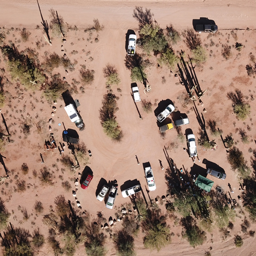
Silverbell Group Camp Site
The Silverbell Group Camp Site is located adjacent to Silverbell Road, north of Ragged Top Mountain.
It is an excellent spot for recreational camping, providing a pull-through for larger vehicles and trailers. Road conditions to the site are highly variable and sometimes require high clearance vehicles. To get there you must travel approximately eight miles on a dirt road which is not regularly maintained.
Volunteers have helped enhance this site by relocating vegetation and placing boulders to guide vehicle traffic. Volunteers also help maintain the site by making sure visitors remove all their trash and maintain primitive fire pits.

To access the site, visitors take the paved Silverbell Road past the small town of Red Hill to where it turns into a dirt road. From there, it is eight miles around the bends and through the washes of Silverbell Road to arrive at the site. Please follow “Leave No Trace” principles for camping, don’t destroy any vegetation, and leave the site better than you found it.
Take a virtual tour of the Silverbell group camp site.
Waterman Restoration Site
The Waterman Restoration Site is home to an amazing story of what volunteers can accomplish.
In the 1980’s a man lived and illegally graded an airstrip on this area of land managed by the Bureau of Land Management — an area which would become part of Ironwood Forest National Monument when it was created in 2000.
After the man and his family were forced to leave, the highly disturbed land became a waist-high monoculture of invasive buffelgrass. In 2005, AZ Sierra Club held “Buffelgrass Pull” events once a year, but the buffelgrass came back aggressively each year. BLM paid contractors to spray the site in the summers of 2008 and 2009. The spraying helped, but did little to abate buffelgrass regrowth and germination each year.
Starting in 2010, the Tucson Chapter of the Arizona Native Plant Society (AZNPS) began a decades-long process of consistent restoration activities. Numerous volunteers from Arizona Native Plant Society, Dove Mountain Hiking Club, Boy Scouts of America, the University of Arizona, and Friends of Ironwood Forest have supported many types of restoration activities including weed abatement, planting seeds, and water harvesting.
A more in-depth explanation of the restoration process can be found here.


Visitors can access the site via a 2-mile paved road off Avra Valley Road. There is a parking area where the former airstrip is very visible. AZNPS has created an interpretive area where visitors can learn to identify the Sonoran desert plants that are taking hold in the restoration area. Visitors are asked to NOT walk in the restoration area as there are many young cacti, trees, and bushes that volunteers have painstakingly planted and tended to that can be easily killed by an errant footstep. After many years of destructive disturbance, the site is now tended by volunteers whose dedication is leading to a new era of regrowth of native plants.
To learn more about Arizona Native Plant Society’s work here or volunteer with them for this or other projects, check out their Waterman Restoration Project page.
Take a virtual tour of the Waterman restoration site.